


Summer's Silent Killer: Over 61,000 Heat-Related Deaths in Europe.
A New Algorithm Maps Heat Islands and Brings Life Back to the City
When asphalt beneath your feet reaches 63°C in mid-summer and car interiors jump to over 70°C: an Israeli mathematical breakthrough successfully maps urban risk hotspots down to the path, station, and bench level - without installing a single physical sensor on the ground.
By: Technology & Urban Planning News Desk • 3 min read
Over 93% of Israel's population currently resides in dense urban environments. For the vast majority, stepping onto the street on an ordinary summer day has become a genuine health hazard: recent surveys reveal that approximately 90% of urban areas in Israel suffer from a complete lack of shade.
The "Urban Heat Island" phenomenon is not a vague twist of fate. It is the direct result of heat accumulation in concrete buildings, dark asphalt roads, and human infrastructure.
At midday, while the surrounding air is scorching, street asphalt surfaces reach a dangerous 63°C, and dark structures climb to 45°C-55°C.
90%
Urban areas in Israel without shade
70°C+
Interior temperature of a car parked in direct sunlight
63°C
Urban asphalt temperature at peak summer
The health hazard doesn't stop at discomfort: studies show that extreme heat stress increases the likelihood of heatstroke by 30%, respiratory issues and dehydration by 20%, and emergency room visits by 15%. Furthermore, when temperatures exceed 33°C, human working and functional capacity drops by about 50%.
No Field Sensors Required: The Mathematical Revolution Changing the Game
Until now, efforts to address urban warming stalled at two main barriers: deploying expensive, hard-to-maintain physical sensors across streets, or relying on vague, unfounded planning statements like "let's plant trees."
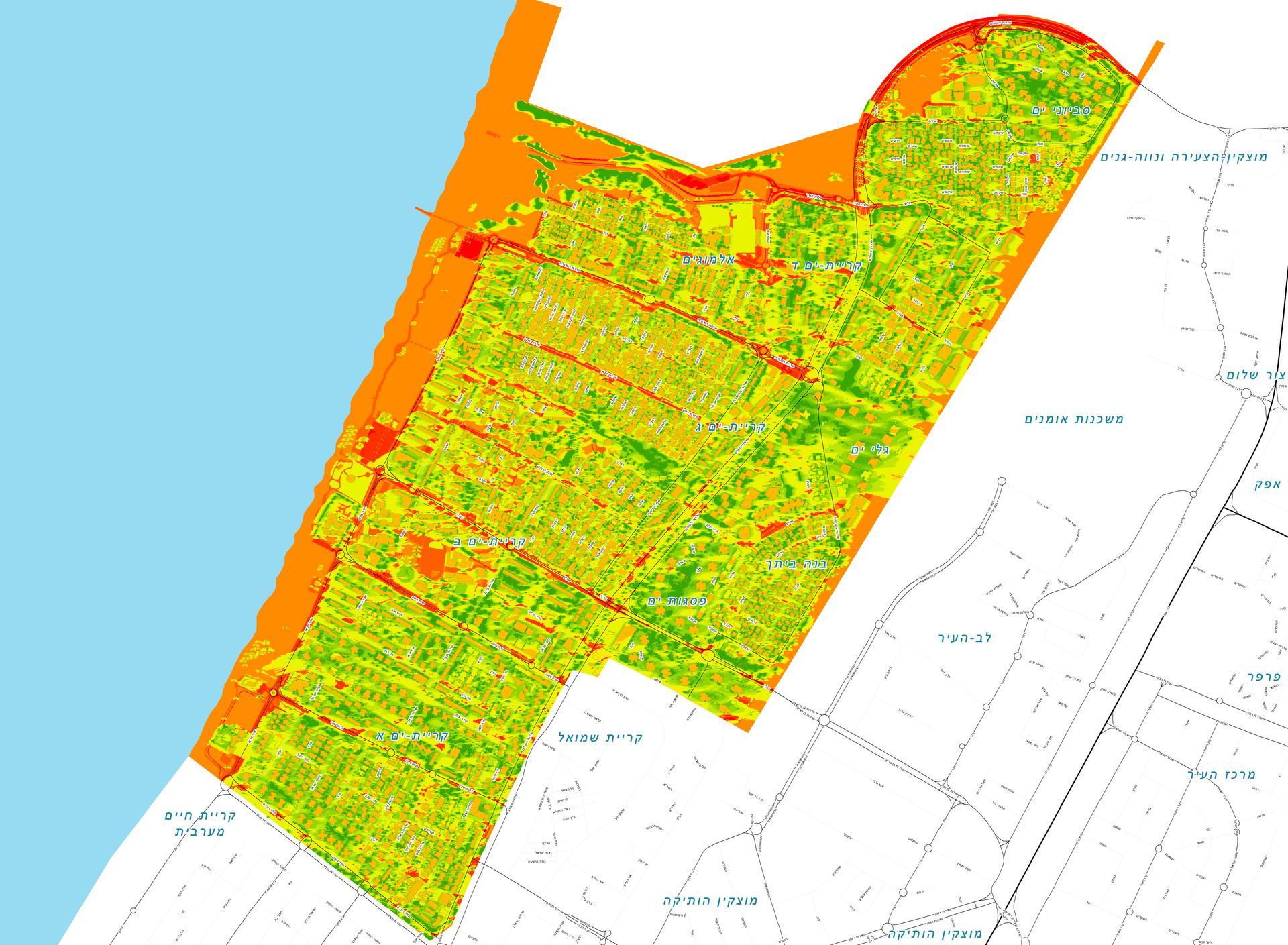
Now, a unique methodology developed by HAMMER GIS presents a conceptual and technological breakthrough: mapping urban heat islands at unprecedented spatial resolution - without installing any sensors on the ground.
"We are shattering unfounded planning paradigms.
The model is revolutionary, generating targeted mapping that provides surgical answers:
Where exactly to plant? How much?
And what will be the exact impact on the street?"
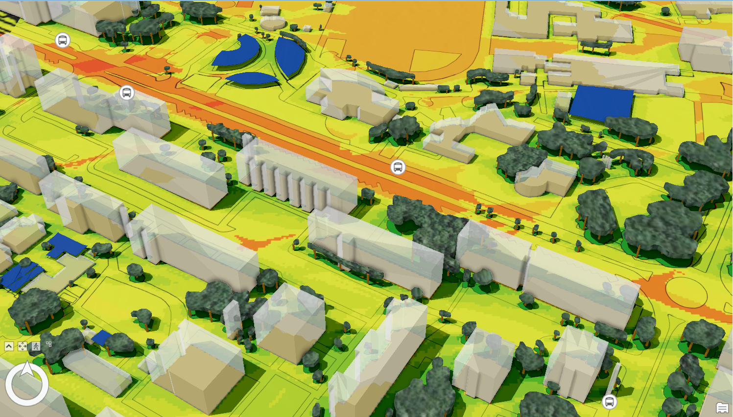
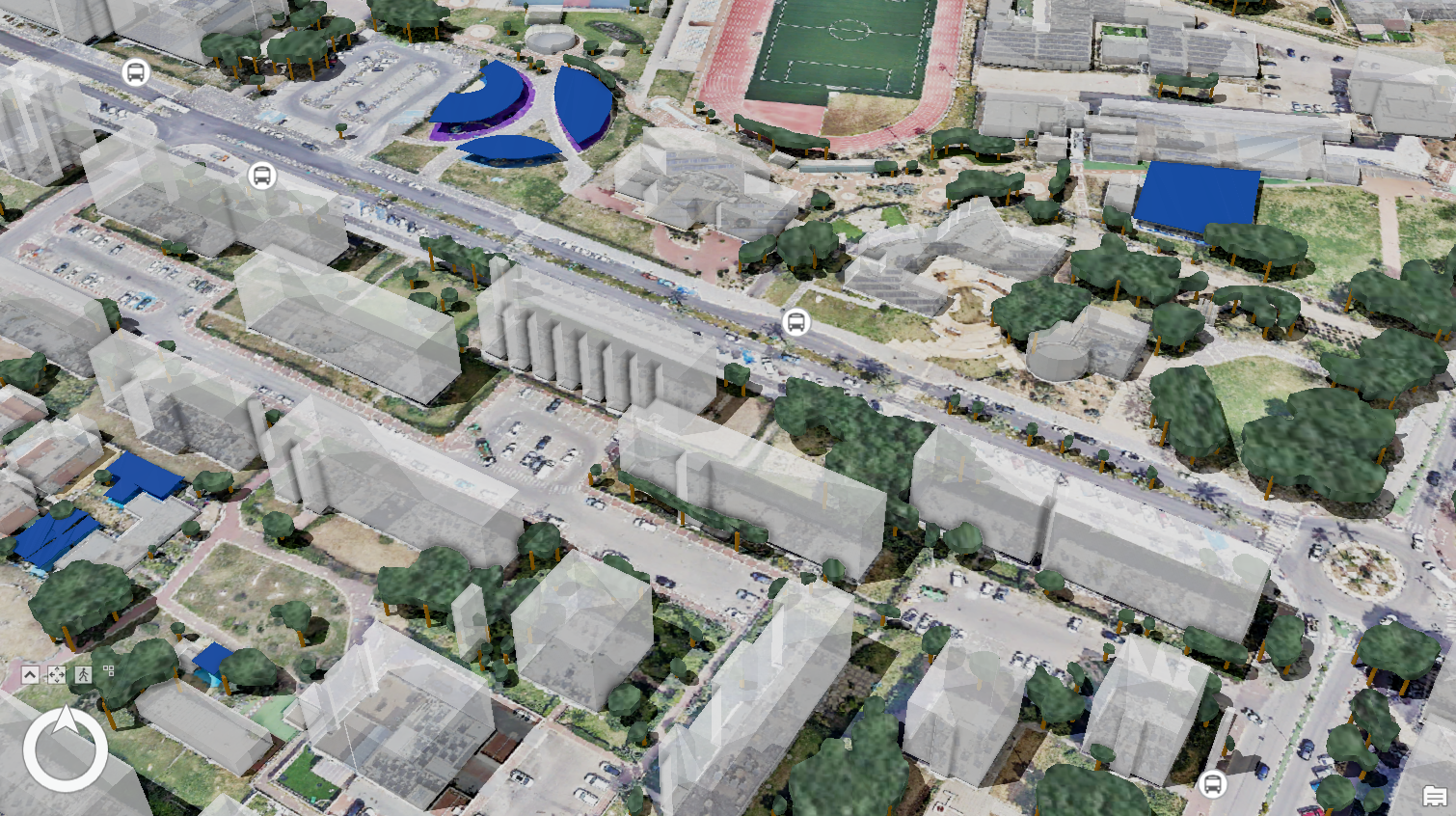
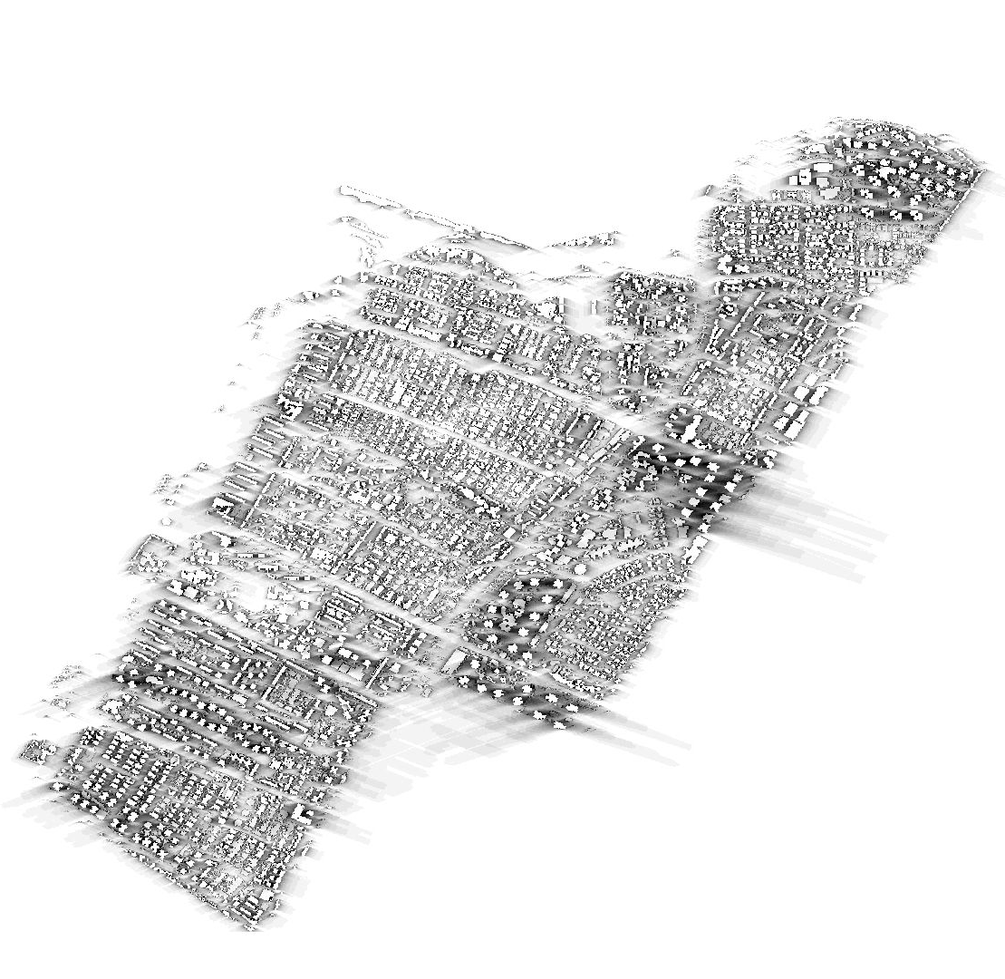
Instead of passively measuring heat, the advanced mathematical model combines solar radiation calculations, sun exposure duration analysis, varying shade times throughout the day, and dynamic thermal response of different urban materials - such as asphalt, concrete, metal, and wood. Combined with 3D elevation models (DSM) and remote sensing, the system generates an operational map displaying critical heat hotspots down to the individual path, station, and bench.
Economic & Municipal Impact: Restoring Life and Commerce to the City
The transition to data-driven thermal mapping generates proven,
multi-dimensional benefits for local authorities and residents:
Infrastructure and Energy Savings:
Targeted investment in shading and green infrastructure lowers municipal infrastructure maintenance costs by up to 15% annually and reduces cooling energy consumption by approximately 20%.
Reducing Emergency System Loads:
Surgical intervention at heat hotspots reduces the load on health and emergency services by 20% during heatwaves.
Dramatic Cooling in the Shade:
While a car in direct sunlight heats to over 70°C, parking or spending time under a tree canopy maintains a cool 23°C to 25°C - a 15°C to 20°C drop in interior temperature.
Encouraging Active Commuting & Local Economy:
Creating shaded walking and cycling routes brings residents back to public spaces, increasing local economic activity and commerce by up to 20%.
Proven Expertise in Thermal Mapping & Analysis
The expert team at HAMMER GIS brings rich, proven experience in Geographic Information Systems (GIS), Remote Sensing, and Artificial Intelligence (AI).
The success of our projects, such as the Kiryat Yam pilot which achieved an 8-degree temperature reduction, relies on our unique ability to integrate precise 3D models with pixel-level thermal data. This expertise allows us to create an accurate urban "thermal twin" for the authority, serving as a solid foundation for life-saving planning decisions. We commit to full transparency and providing reliable data that meets the highest professional standards.
Promoting Active Commuting - Bringing Pedestrians and Cyclists Back to Streets
A continuous, cooled shade network transforms the urban street from an environmental hazard into a shaded green lung that encourages active living.
Urban heat islands drive residents away from public spaces. Through precise AI mapping, local authorities can plan walking and cycling paths protected by trees and shade pergolas at temperatures 8 degrees lower than the exposed street. These solutions encourage "active commuting" (walking and cycling) over private vehicle use, contribute to public health, reduce air pollution, and bring life and commerce back to city streets.
